


Hauser Lake
Within minutes of starting this hike, the noise of the busy Beartooth Highway fades away. Watch for marmots scurrying among the rocks and listen for the high chirp of native Black Rosy-Finches in the trees. Hauser Lake lies within the relatively flat and high Beartooth Plateau, which was created by glacial activity over millions of years. At the high point of the trail, look for evidence of glacial erosion all the way to the horizon. Kettle lakes, rounded boulders, glacial till, and terminal moraines are all visible from this trail.

Kitty Creek Hiking
Kitty Creek Trail climbs eight miles from the North Fork Highway into the Washakie Wilderness, but this well-maintained trail is suitable for all levels of hikers. With beautiful views all along the way, this hike can be shortened to match the ability levels of the group. After a journey through alpine meadows, the trail ends at Flora Lake, on a high saddle, with a dramatic view of the steep and rugged Washakie Wilderness backcountry.

Long Lake - A Bighorn Cruiser
This popular 6-mile out-and-back trail climbs gradually to two alpine lakes in the Bighorns. With its short distance and gentle incline, this trail could also be a fun introduction to hiking or backpacking for kids.

Three Adventures In July Around Northwest Wyoming
It’s time. Peak hiking season is finally here in northern Wyoming. If you are looking for a great way to get out and stretch your legs - or just get away from the hustle of Cody for a day - we have some ideas about how to make it happen.

Mormon Creek - Into the High Country
Starting from the North Fork Highway at 6,500 feet, this trail climbs through an evergreen forest alongside Mormon Creek. At trail’s end, it reaches a high alpine saddle at 10,300 feet with views of Sleeping Giant Mountain above and the deep gorge of Grinnell Creek far below.

Hiking Pilot Creek
This 6-mile trail parallels Pilot Creek from the Beartooth Highway almost to its headwaters near the boundary of Yellowstone National Park. The trail includes cliff top views across the river canyon, where seasonal waterfalls cascade from every peak.

Porcupine Falls
This one-mile round trip hike to a waterfall is located east of Lovell in the Bighorn National Forest. From the parking area, the trail drops 440 feet in half a mile, but the beauty of the waterfall makes the climb back out well worth it.

Four Bear Trail
The Four Bear trail leads to the beautiful 7,600-foot summit of Four Bear Mountain with views of the Wapiti Valley and north toward Sunlight Basin. It is a fun and adventurous trail in its own right, as well as a backpackers’ gateway to the North Absaroka Wilderness.
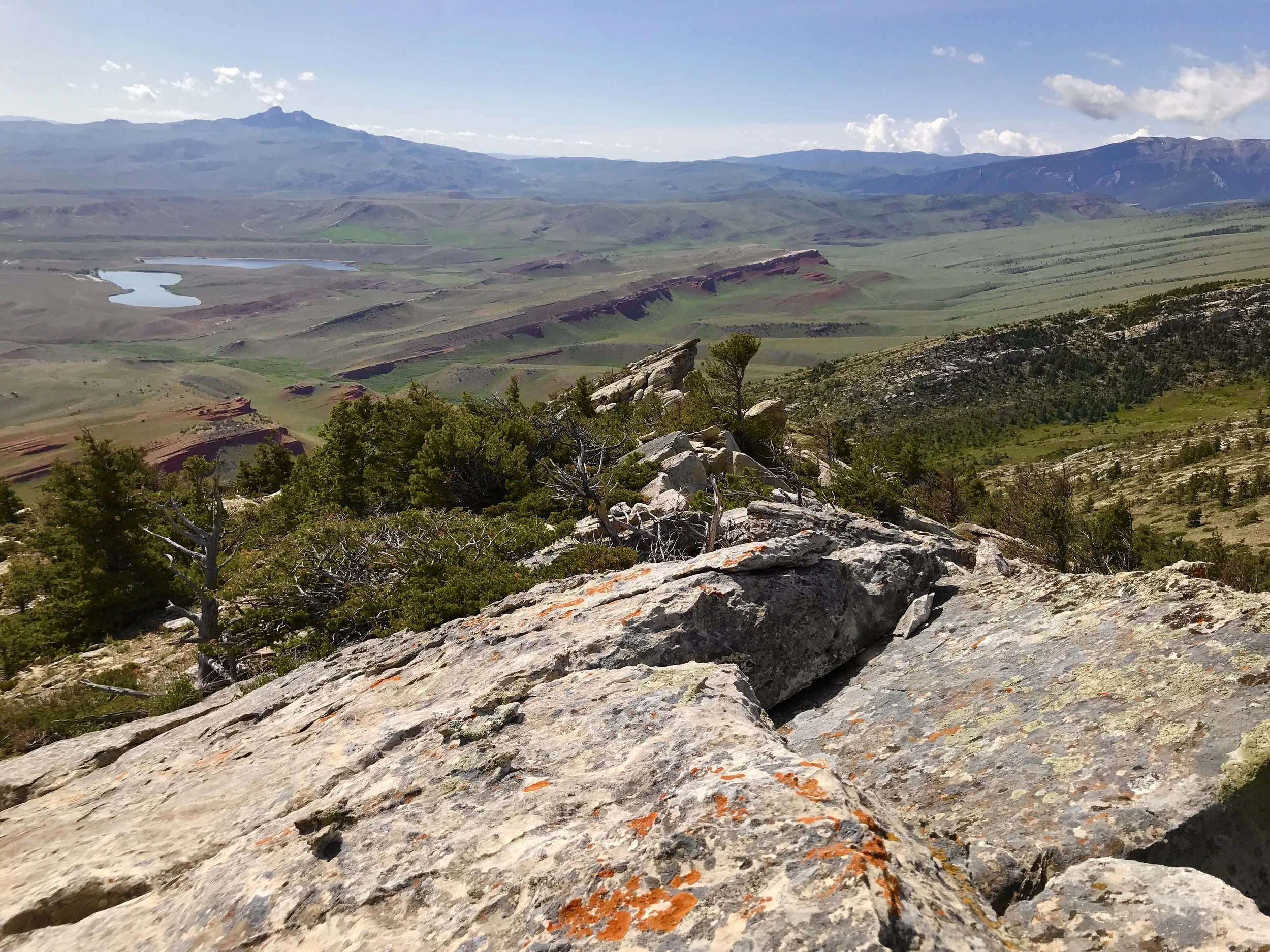
Bald Ridge - A Climb worth the time
The approach-and-loop hike up 6,600 foot Bald Ridge is a calf-burner, but the high point has broad, flat rocks arranged like stadium seating. Have lunch on the top with views all the way to the Bighorn Mountains before heading back to the trailhead.
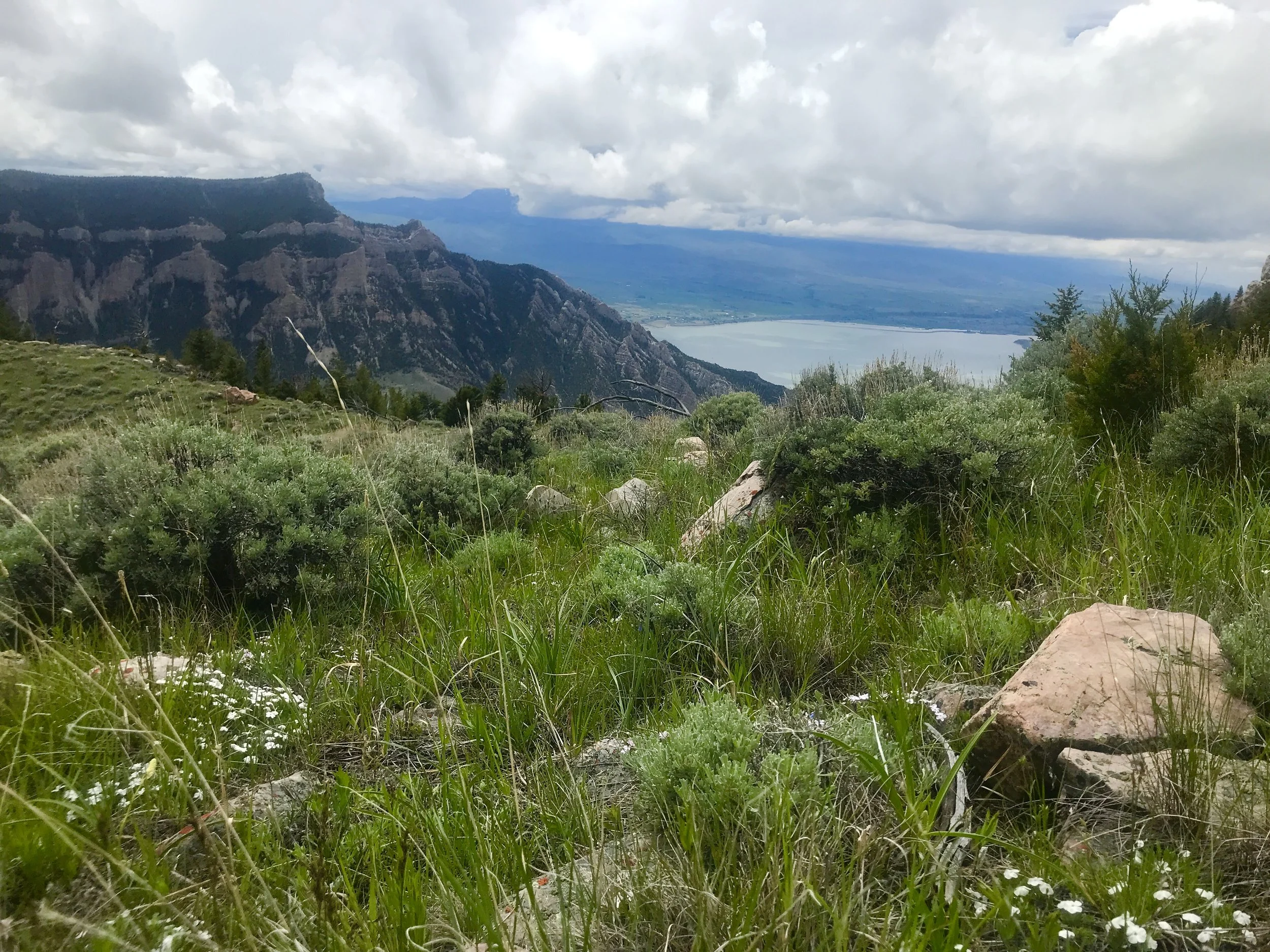
Rattlesnake Mountain - Wilderness on the edge of Town
Experienced hikers who enjoy a rugged and challenging climb will love this route, available so close to Cody. Locals drive by this mountain daily without realizing the natural wonderland waiting above our heads. The east slope of Rattlesnake has elk, mule deer, pronghorn, jackrabbits, grouse, and Wyoming ground squirrels, who chirp loudly from their rocky dens.