Little Sunlight
The Little Sunlight Trail runs alongside Little Sunlight Creek just beyond the boundary into the North Absaroka Wilderness. You can choose to do this hike as a loop or an out-and-back adventure. The trail offers stunning views, opportunities for wildlife sightings, and a beautiful drive to the trailhead.
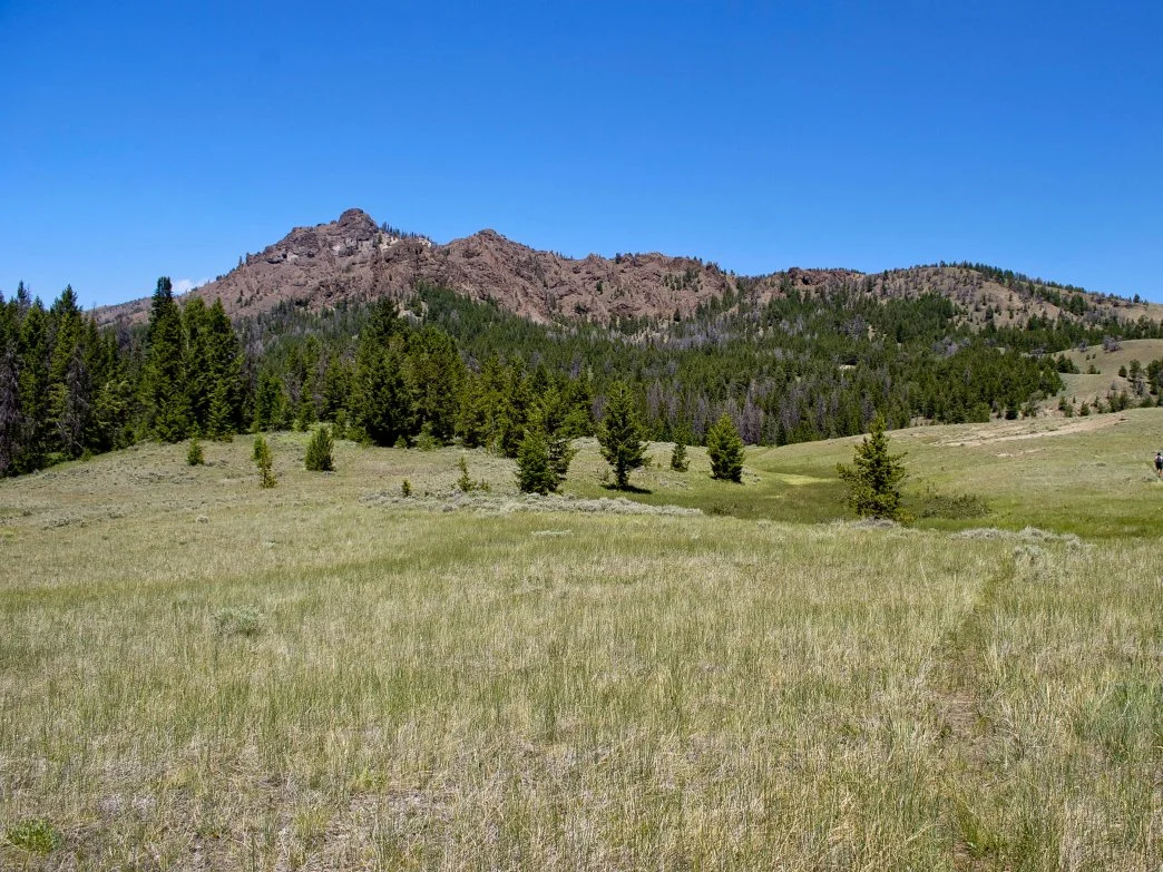
The view from the Little Sunlight Trail
DIFFICULTY: 2
TIME TO COMPLETE: 4 hours
DISTANCE: 6.9 miles, loop
SEASONALITY: Late Spring, Summer, Early Fall
FEES/PERMITS: No
DOG FRIENDLY: Yes
DESTINATION HIGHLIGHTS: A loop through wide-open mountain meadows
INTRO: The Litte Sunlight Trail winds through the shadows of several 10-11,000 foot peaks that separate the North Fork of the Shoshone River and the Sunlight Basin area. This moderately challenging seven-mile trail takes hikers through old forests, along ridgeline 5. and across meadows, offering something for evervone to enjoy. The trail starts with a short uphill section, followed by some downhill terrain, with a final uphill stretch to a saddle before returning to the starting point. It's best to hike this trail on weekdays to avoid the heavy local traffic from weekend campers and ATVs on the Sunlight Basin Road.
WHAT MAKES IT GREAT: This area is a wonderful getaway for a couple of days.
Hikers can camp at Little Sunlight Campground and spend their time hiking fishing. and enjoying the outdoors. The drive to the trailhead delights the eye with ever-changing scenery: sagebrush flats leading to red buttes surrounded by emerald green grass, high alpine peaks, old forests, burned forests, and wide-open meadows overflowing with wildflowers. What's not to love about just getting to the area?
The trail starts with an uphill climb for the first mile, followed by a hike along a ridge. After 1.1 miles, you will descend from the ridge and begin the loop part of the trail. Crossing Little Sunlight Creek several times is possible without getting wet Hike uphill and navigate through another meadow, aiming for the north saddle. Upon reaching 4.1 miles, you'll reach the saddle, where several other trails converge. Take your time to locate the faint trail directly east or downhill from the top. Keep hiking east, and the trail will become more distinct. For the next two miles, the trail will undulate before descending back into the valley, marking the ending of the loop section. The return journey follows the same path as the inbound route.
WHO IS GOING TO LOVE IT: Folks looking to see more of the local countryside and experience a fairly remote hike will enjoy the Little Sunlight Trail. You have a good chance of seeing lots of wildlife, including deer, elk, moose, and bighorn sheep. This is grizzly bear habitat, so take bear spray and watch for tracks and scat.
DIRECTIONS, PARKING, & REGULATIONS:
From Cody, travel north on WY-120 to the Chief Joseph Scenic Highway, 16.8 miles from town. Turn left, ascend Dead Indian Pass, and then drop down the west side, being mindful of the very sharp hairpin turns. Turn left onto the Sunlight Basin Road at mile 33.8. Stay on this gravel road until mile 50 brings you to the Little Sunlight Campground. There is a huge parking area near the horse corrals with the actual trailhead at the northwest point. Be aware that the drive to the trailhead will take you nearly 2 hours. Plan accordingly.
WANT MORE GREAT HIKES LIKE THIS?
This hike and 94 others are featured in Sunlit Trails, our guidebook to hiking the northwest part of Wyoming. It covers trails from the North Fork to the Beartooths to Yellowstone, with driving directions, difficulty ratings, and the details you actually need before you go. Pick up a copy at Sunlight Sports or order one online.