

Bald Peak
DIFFICULTY: 3
TIME TO COMPLETE: 2 hours
DISTANCE: 3.4 miles out and back
SEASONALITY: Summer, Fall
FEES/PERMIT: No
DOG FRIENDLY: Yes
DESTINATION HIGHLIGHTS: A remote viewpoint over canyons and basins
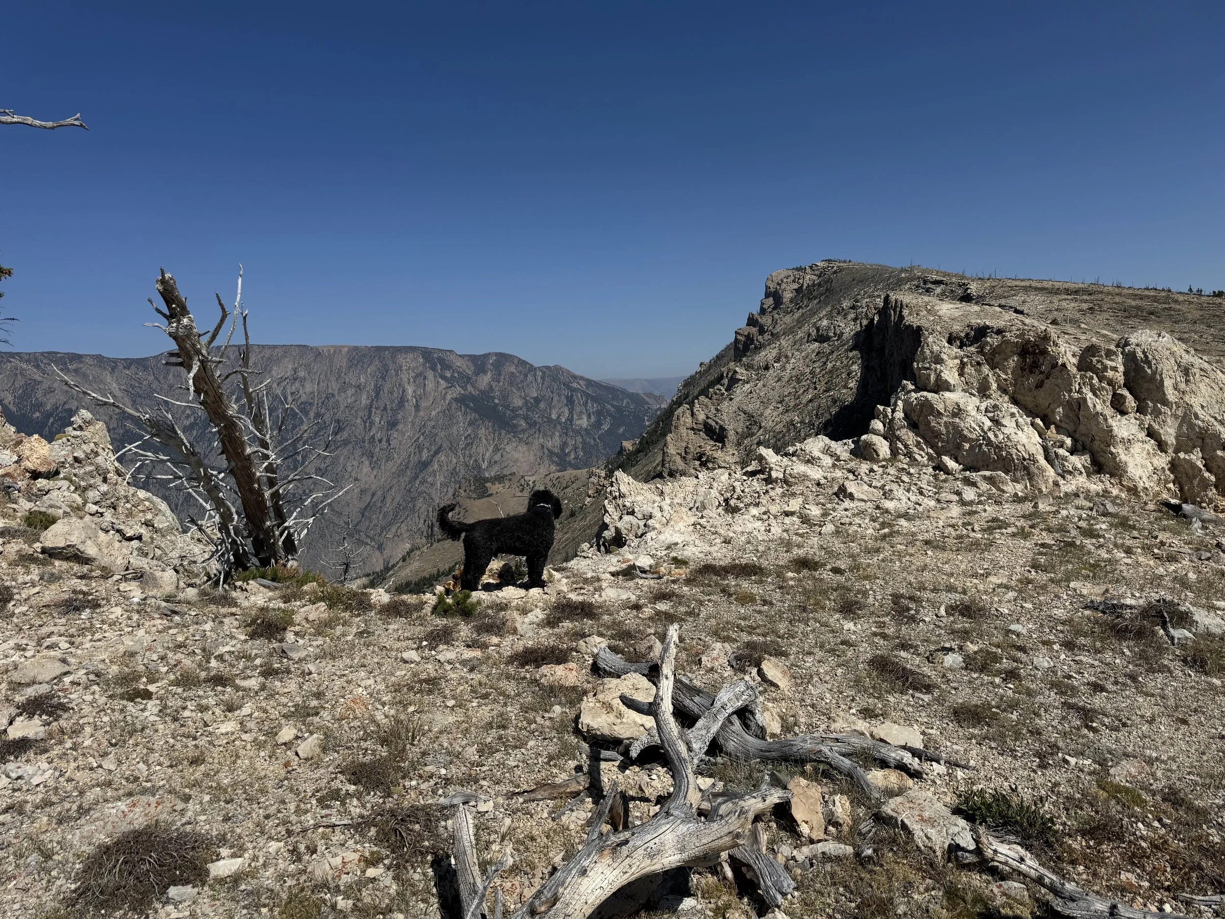
On the way to the top
This out-and-back route follows the south rim of the Clark’s Fork Canyon and delivers expansive views into Sunlight Basin, the canyon below, Heart Mountain, and Cody. Although those landmarks are visible along much of the trail, the setting feels more remote and wilder than you would expect. From the summit of Bald Peak, you can look more than 3,000 vertical feet down into one of the area’s most dramatic canyons.
From the starting point described below, work your way north to the canyon’s edge. When you reach the rim, turn right and keep the canyon on your left as you climb. For most of the hike, you can follow the broad ridge uphill, using intermittent game trails where they appear. Despite its name, Bald Peak is not entirely open. Patches of old timber may push you a short distance away from the edge while you find the best line, but try to stay near the rim when it is safe to do so.
There are several natural places to stop and enjoy the views back into Sunlight Basin. Far below, the river winds through narrow channels and across wide sandbars, and on clear days, the far ridge along the edge of Yellowstone stands out. You will pass a few false summits on the way up. The actual high point is obvious and marked by a low cairn, which makes a good spot to sit, watch the clouds, and take in the 360-degree panorama. Return the way you came. Carry bear spray and use caution near the rim.
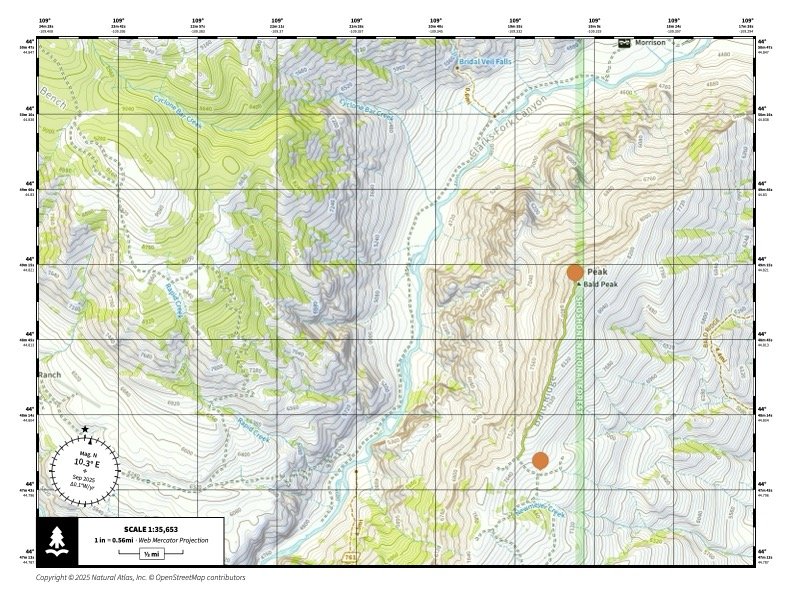
The route map, courtesy of Natural Atlas. If you haven’t tried their excellent app, you should. naturalatlas.com We use it for all of our hike mapping, and suggest it to all of our customers.
WHAT MAKES IT GREAT
This is big country in a compact hike. You get expansive views, dramatic canyon drop-offs, and simple off-trail travel along a ridge for most of the route. Bald Peak also pairs a moderate effort with a recognizable high point that many people can see from town but have never visited. It is an engaging objective for hikers who are ready to move beyond heavily marked trails. Choose a sunny day, and ideally a sunny morning, and avoid this outing when thunderstorms are in the forecast because the road is long and the route is exposed.
DIRECTIONS, PARKING & REGULATIONS
From Cody, drive north on Highway 120 to the junction with the Chief Joseph Scenic Highway. Turn left on Highway 296 and continue for 11.6 miles. Turn right onto Forest Service Road 100 and follow it for 6.3 miles. FS 100 traverses Bald Ridge and is generally in good repair, but a high-clearance four-wheel-drive vehicle is recommended. Expect a few rocky spots that will require you to slow down and pick your line. Travel only in dry conditions because sections of the red Chugwater formation become very slick when wet. You will pass through two gates; close them behind you. Several spur routes branch off the main road (generally signed 100-1B, etc.), but stay on FS 100. At 6.3 miles, the road reaches the edge of the Clark’s Fork Canyon and bends left to the west. Park here; this is the start of the hike.
WHO IS GOING TO LOVE IT
Hikers who enjoy big views and are comfortable near airy edges will love this route. It is not particularly technical, but it offers a satisfying summit and sweeping vistas in every direction. Photographers and new peakbaggers looking for a moderate objective will also appreciate it.