

Clarks Fork Canyon From Lower Dead Indian Trail
Difficulty: 3
Time to Complete: 2-3 hours
Distance: 3.0 miles one way, 6.0 miles out and back
Seasonality: Spring, Summer, Fall
Fees/Permit: No
Dog Friendly: Yes
Destination Highlights: A dramatic ramble along the edge of a wild canyon, with views of rivers and waterfalls
While this hike feels remote soon after leaving the trailhead, and the views down into the vast set of canyons that the Clarks Fork of the Yellowstone inhabits seem incredibly wild, the trail itself is steeped in history - not all of it pleasant. John Colter probably used this route in 1807, but more importantly, this critical piece of trail was a key point on the old Bannock Trail that gave native tribes access to bison in the Big Horn Basin and the Yellowstone Valley. It was also part of the route that the Nez Perce, led by Looking Glass and Chief Joseph, amongst others, used to escape the US Army in the 1870s.
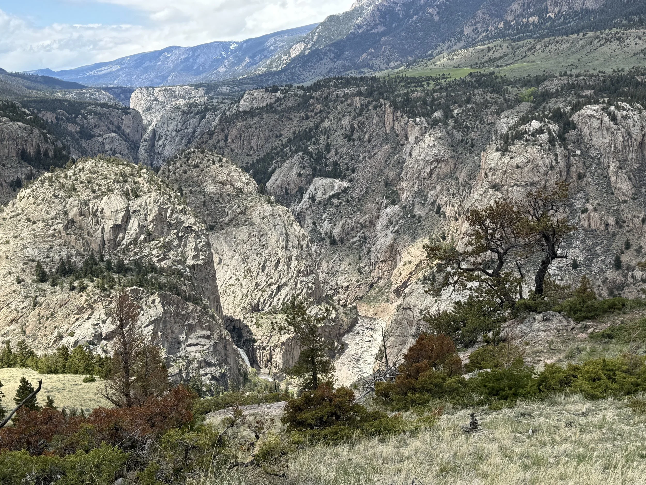
Dead Indian Falls, on the lower left.
Many of the names of the features in this area are related to the flight of the Nez Perce. While that event is too complex to describe here, you should know that the multiple features named “Dead Indian” are not general, but relate specifically to a story of the Nez Perce supposedly tying one of their deceased men onto a horse, and then putting that horse in a very visible area as a bluff to fool the waiting US Army unit, led by Samuel Sturgis. Whatever the details of that particular legendary ruse actually were, the Nez Perce successfully passed along this trail and were able to escape through the eastern mouth of the canyon below.
Who is Going to Love It: If you love big views, this is a great place to start exploring both Sunlight Basin and the Clarks Fork Canyon. The additional layers of history add a level of pathos, as you imagine the people who used this passage throughout history.
What Makes It Great: This is an excellent early- and late-season hike. Sitting along a windswept bench above the canyon, the combination of middle elevation and persistent wind keeps the trail surprisingly clear for a north-facing route.
And what a route! As the trail gradually works its way east, the epic core of the Clarks Fork canyon in Sunlight Basin gradually comes into view. Dead Indian Falls is visible from some of the trail, as are the remote canyon bottoms that hold some of the best - and hardest to access - fishing in the state.
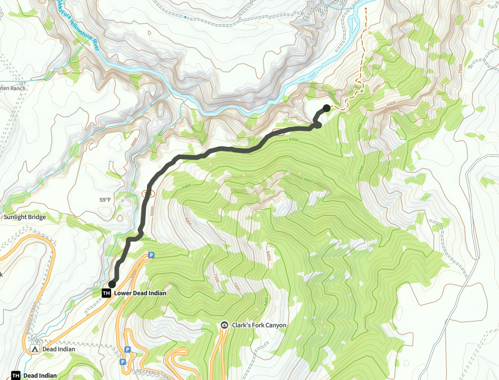
A map of the hike, courtesy of the excellent hiking app Natural Atlas.
From the generously sized parking lot, the obvious trail heads east, passing through two separate gates that bracket a protected test area of range. Make sure to leave any gates the way that you find them.
This trail, done as an out-and-back, is generally downhill from the trail head, although the trail rolls enough that there are plenty of short climbs no matter which way that you are traveling.
Keep an eye out as you walk east - the spectacular Dead Indian Falls reveals itself below, and somewhat behind you, around 1.5 miles into your trip. This description generally assumes that you will turn around at a lookout that reveals the entire rest of the canyon to your east. It does, however, continue steeply downhill and all the way to the Clarks Fork itself, 4.4 miles from the trailhead.
Directions, Parking & Regulations: Drive north from Cody on Highway 120 to the junction with the Chief Joseph Scenic Highway. Turn left on that road (Highway 296) and continue for 20 miles. Turn right onto the first dirt road, with the trailhead sign, after completing the descent of the highway switchbacks. If you reach the Dead Indian USFS Campground, you have gone too far.