

Backpacking Yellowstone's Hoodoo Basin
Difficulty: 5
Time to Complete: 3-4 days
Distance: 48 miles round-trip
Seasonality: Summer, Early Fall
Fees/Permit: Yes - Yellowstone entrance fee and backcountry permit required
Dog Friendly: No
Destination Highlights: One of the most remote and spectacular backpacking destinations in Yellowstone, volcanic hoodoo formations, extraordinary wildlife, high alpine solitude
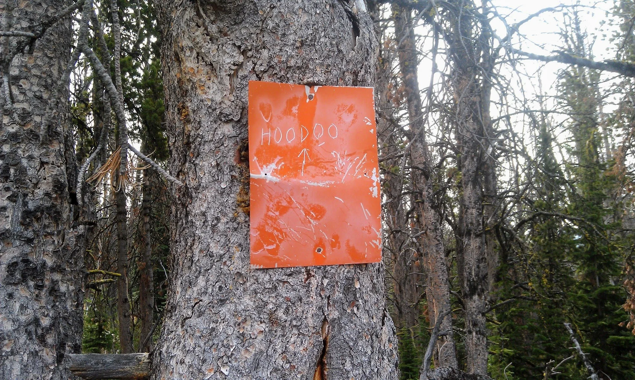
A sign to keep you on track
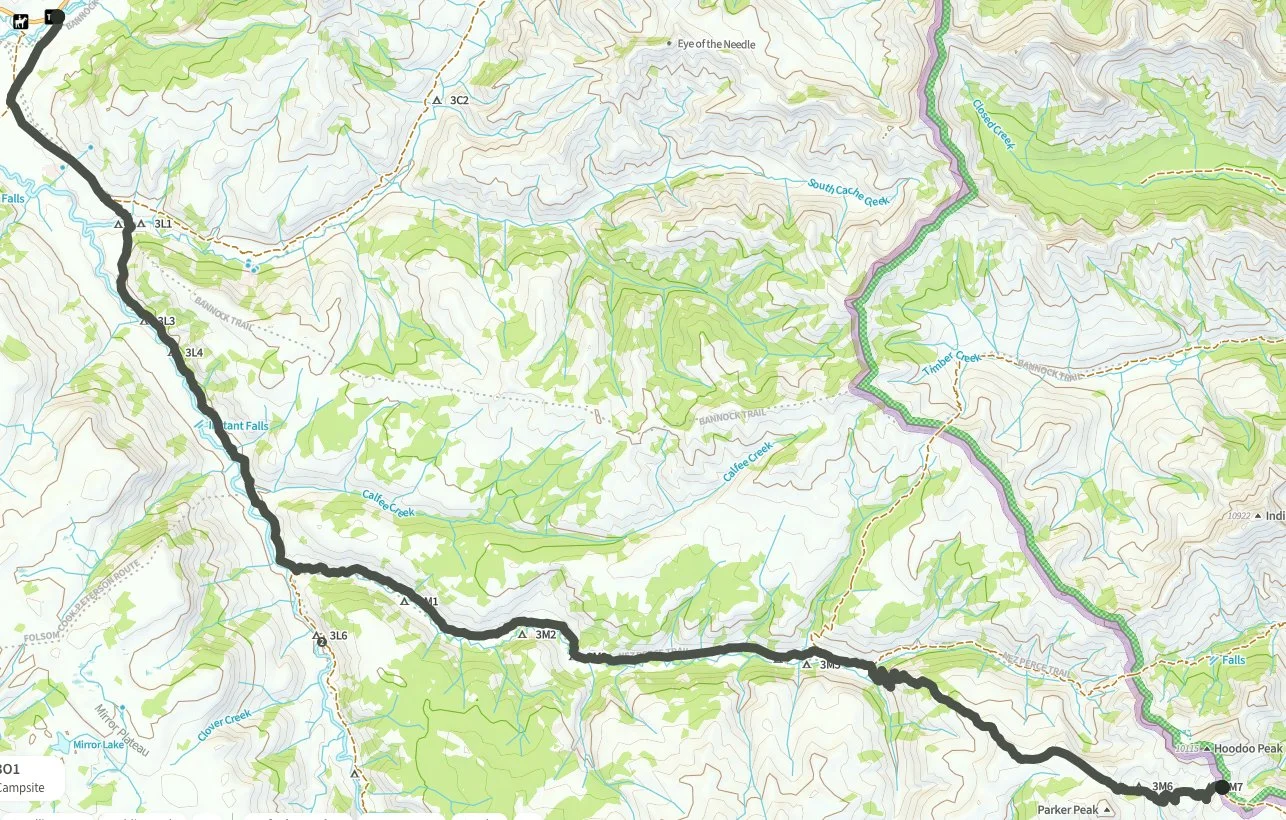
Summary: This multi-day backpacking trip travels 24 miles from the Lamar River Trailhead deep into the eastern backcountry of Yellowstone, following the Lamar River and Miller Creek before climbing 2,100 feet over the Parker Peak saddle and descending into the volcanic rock formations of Hoodoo Basin. Plan on three nights out and reserve your backcountry campsites well in advance.
Intro: From the Soda Butte Trailhead, the Lamar River Trail heads southwest through one of the most wildlife-rich valleys in North America, with all of the attendant tourist traffic. But soon, the wide, open floor of the Lamar Valley gives way to a narrower drainage as you move up the Lamar River Trail. By the time you have traveled 3.3 miles and forded Cache Creek (which can run swiftly early in the season), you will be in true Yellowstone backcountry.
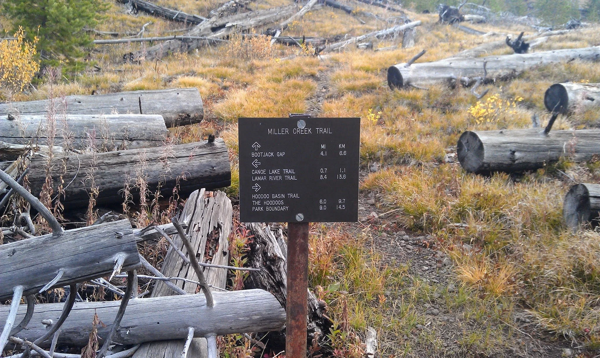
The sign at the junction of Miller Creek
At 8.5 miles, look for the Miller Creek Trail junction. The Miller Creek Trail climbs into a wilder and far less-visited portion of the park. The canyon narrows and the trail winds through forest and open meadow alongside the creek. Campsites 3M2 and 3M3 in the Lower Miller Creek area are good options for your first night, at roughly 10-12 miles from the trailhead. On day two, continue up-canyon to the Upper Miller Creek campsites 3M4 and 3M5 near the patrol cabin at roughly 16.5 miles. The patrol cabin marks a transition point.
From the patrol cabin, the Hoodoo Basin Trail immediately crosses Miller Creek. By early to mid-July, this ford is usually no more than a foot or so deep. Fill your water bottles here, as water becomes scarce on the climb above. Past here, the trail feels different - it climbs quickly and feels very remote. By early September, the only tracks in the soft trail past the cabin might be from wolves and bears.
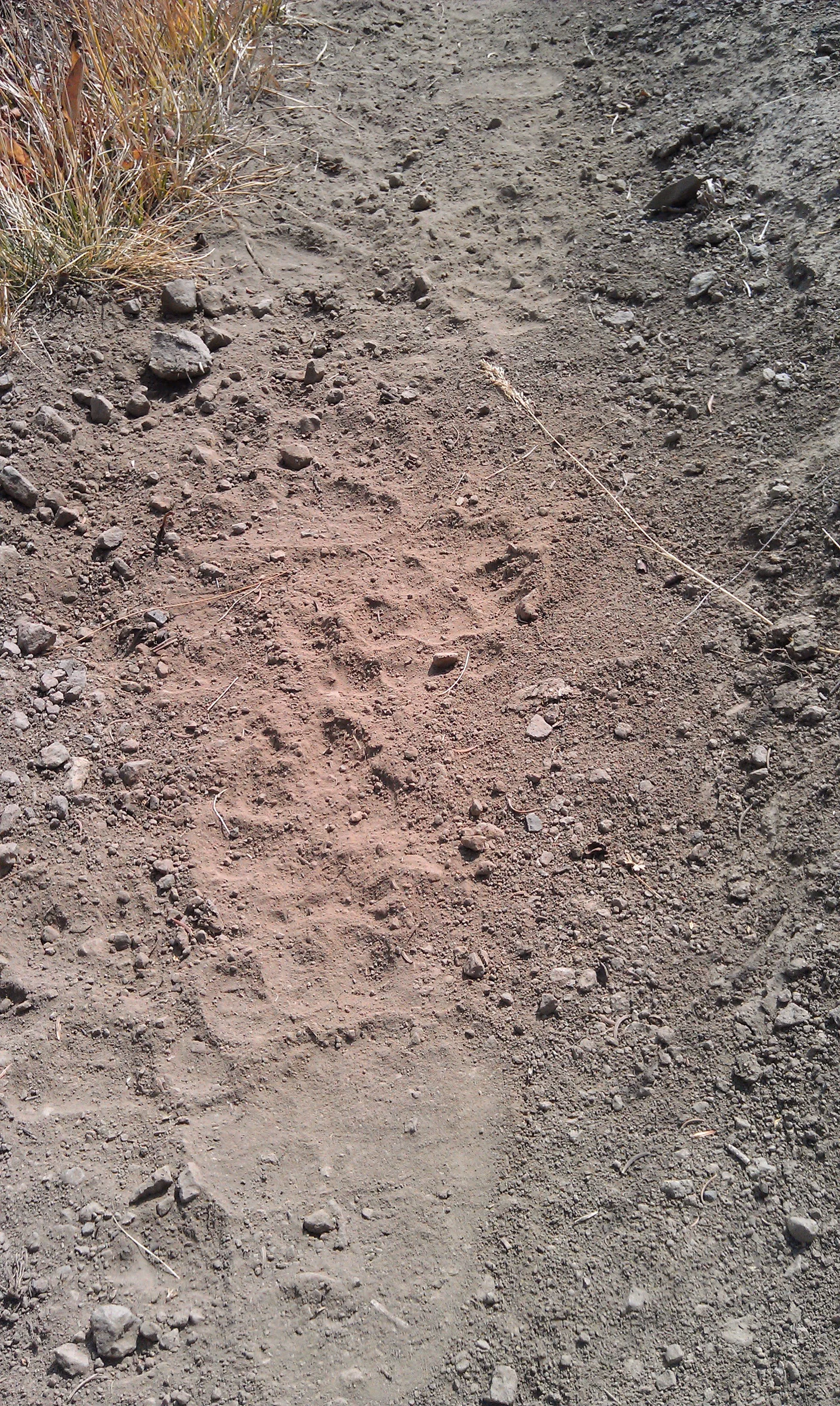
Local traffic signs
The trail switchbacks steeply up an open ridge, gaining 1,000 feet in the first 1.5 miles. The views of the high Absaroka Range open up with every step. The grade eases slightly, but the climbing continues, gaining another 1,000 feet over the next 3 miles. At 4.7 miles from the Bootjack Gap junction, the trail reaches the saddle just north of Parker Peak at 9,600 feet. The 10,203-foot summit of Parker Peak rises directly to the south, its permanent snowfield feeding a thin, intermittent meltwater creek down through the alpine terrain below. The views from the saddle - the Lamar Valley to the west, the Mirror Plateau to the south, the northern Absarokas in every direction - are among the best in the park. This area is rife with grizzly bears, especially in the late season, when they feed on moths that collect on the talus slopes. Keep your eyes open and make noise.
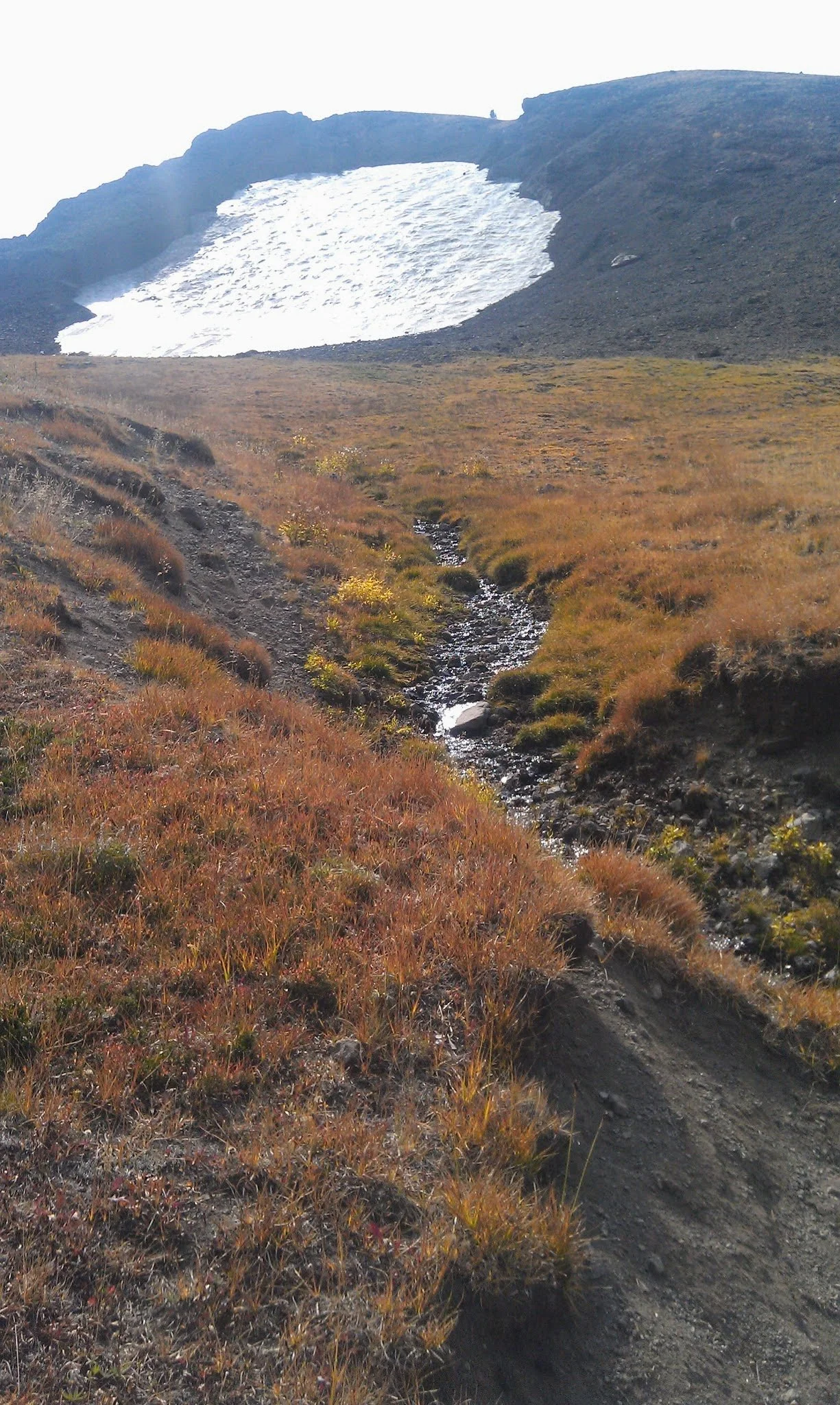
Parker Peak in the fall
From the saddle, the trail descends into Hoodoo Basin. The hoodoos come into view gradually - eroded volcanic pinnacles in curious and fantastic forms, including towering shafts, mounds, and pyramids that an 1883 visitor compared to a gigantic altar pyre. They seem to change depending on where you stand and what time of day the light hits them. Walk around the basin and take your time. The spur trail to campsite 3M6 is around 5 miles in on the Hoodoo Basin Trail, set just above and across from the formations. The spur to 3M7 is at 6.6 miles, just west of the park boundary. If you are doing a shuttled trip, from 3M7, the trail continues another 3 miles to the park boundary at 10,470 feet, where it connects to Trail 606 down the Sunlight Creek drainage into Shoshone National Forest.
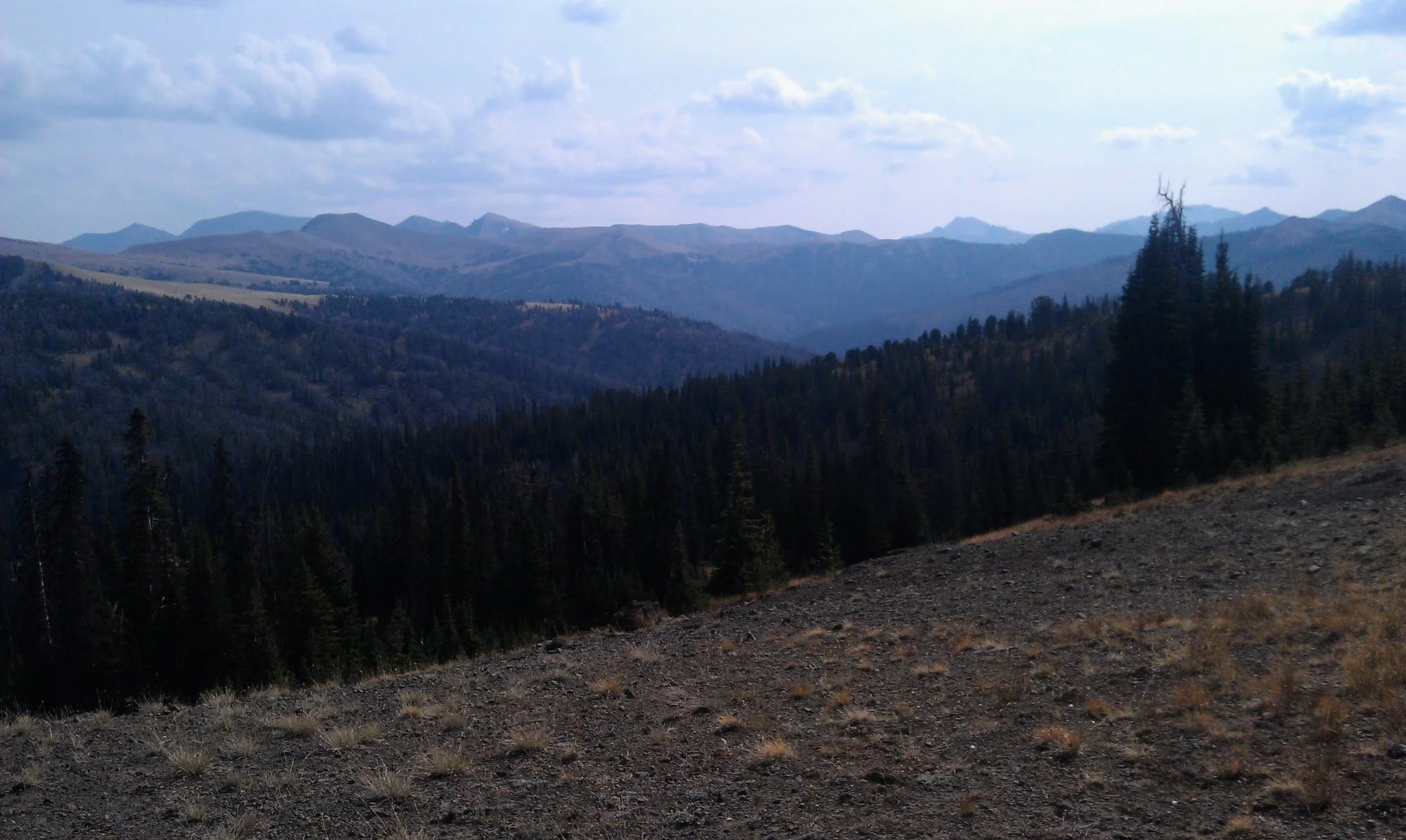
The Absarokas on the way to Hoodoo Basin
What Makes It Great: Yellowstone gets four million visitors a year. Almost none of them come here, to what is arguably the park's most unique spot. Superintendent Philetus Norris, the first paid superintendent of the park, called Hoodoo Basin "Goblin Land" when he explored it in 1880. He was so taken with the area that he had the trail built that visitors use today. The hoodoos themselves are volcanic formations, shaped by 50 million years of eruption and erosion into forms that previous visitors have said resemble gargoyles, giants, and figures that can’t be described. Photographs don't do it justice.
Who Is Going to Love It: Experienced backpackers who are ready for a serious multi-day effort and want genuine solitude. The mileage is significant, the creek crossings are real, and grizzly activity is present throughout the route. Hikers who have done the Thorofare or spent time in the Lamar corridor might find this trip feels even more remote. Wildlife photographers and anyone drawn to the human and geologic history of the Absarokas will find Hoodoo Basin unlike anything else in the park.
Directions, Parking & Regulations: The Soda Butte Trailhead is on the Tower Junction-Northeast Entrance Road, 15 miles east of Tower Junction and 4.3 miles east of the Lamar Ranger Station, and 94.8 miles from downtown Cody via Cooke City. A Yellowstone entrance fee is required, and a backcountry permit is required for all overnight stays and must be picked up in person at a park backcountry office no more than 48 hours before your trip start date.
Reserve campsites 3M2 or 3M3 for your first night and 3M6 or 3M7 for your night in the basin, selecting a site in the Lamar corridor for your last day. An alternative worth considering: book two consecutive nights at 3M5 and hike to Hoodoo Basin as a long day trip on the middle day. The round-trip from the Upper Miller Creek area to the basin and back is roughly 15 miles with significant elevation gain, but a day pack makes a real difference on the climb to the Parker Peak saddle. Note that both 3M6 and 3M7 have little, if any, water during the latter part of the season - plan accordingly.
Dogs are not permitted on trails in Yellowstone National Park. No cell service is available along this route.
Map courtesy of Natural Atlas, simply the best hiking app on the market. You should use it.